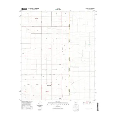
2013 Map of Pleasant Hill
USGS Topo · Published 2013About this map
The agricultural community of Pleasant Hill stands at the center of this 2013 survey of northeastern Curry County, where the High Plains landscape of New Mexico meets the Texas state line. The map captures a specialized rural economy defined by significant dairy operations, including Ridgecrest Dairy, Providence Dairy, and the Cross Country Dairy. These industrial-scale farms are situated within a vast grid of county roads, such as Co Road 23 and Curry Road D, that structure the territory.
Find a feature on this map
31 named features on this map. Tap any name to fly to it.
Don’t see what you’re looking for? This feature index may not catch every label — zoom into the map to look around manually.
Map Details
Editions of this 2013 Pleasant Hill Map
This is the sole edition of this map. No revisions or reprints were ever made.
Other maps of this area

1954 · Clovis
USGS Topo · 1:250,000

1957 · Clovis
USGS Topo · 1:62,500

1957 · Pleasant Hill
USGS Topo · 1:62,500

1958 · Clovis
USGS Topo · 1:250,000

1963 · Oklahoma Lane
USGS Topo · 1:24,000

1965 · Bovina
USGS Topo · 1:24,000

1965 · Rhea
USGS Topo · 1:24,000

1985 · Pleasant Hill NW
USGS Topo · 1:24,000

1985 · Muleshoe
USGS Topo · 1:100,000

1985 · Pleasant Hill
USGS Topo · 1:24,000