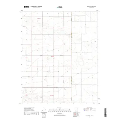
2020 Map of Pleasant Hill
USGS Topo · Published 2020About this map
Pleasant Hill anchors this High Plains landscape along the prominent New Mexico - Texas state line. The community is defined by its agricultural grid, where a network of numbered and lettered routes like Curry Road B and C R 18 facilitate local transit across the border into Parmer County. This contemporary map details the drainage patterns of the region, specifically Running Water Draw in the south and Catfish Draw to the east, which carve subtle relief into the flat terrain. Genealogists and local historians will find the Pleasant Hill Cem clearly marked north of the primary settlement, situated near the intersection of Co RD 19 and Curry Road B. The map illustrates the persistent intersection of state boundaries and rural life, where Fm 2290 bridges the geographic divide between the two states.
Find a feature on this map
33 named features on this map. Tap any name to fly to it.
Don’t see what you’re looking for? This feature index may not catch every label — zoom into the map to look around manually.
Map Details
Editions of this 2020 Pleasant Hill Map
This is the sole edition of this map. No revisions or reprints were ever made.
Other maps of this area

1954 · Clovis
USGS Topo · 1:250,000

1957 · Clovis
USGS Topo · 1:62,500

1957 · Pleasant Hill
USGS Topo · 1:62,500

1958 · Clovis
USGS Topo · 1:250,000

1963 · Oklahoma Lane
USGS Topo · 1:24,000

1965 · Bovina
USGS Topo · 1:24,000

1965 · Rhea
USGS Topo · 1:24,000

1985 · Pleasant Hill NW
USGS Topo · 1:24,000

1985 · Muleshoe
USGS Topo · 1:100,000

1985 · Pleasant Hill
USGS Topo · 1:24,000