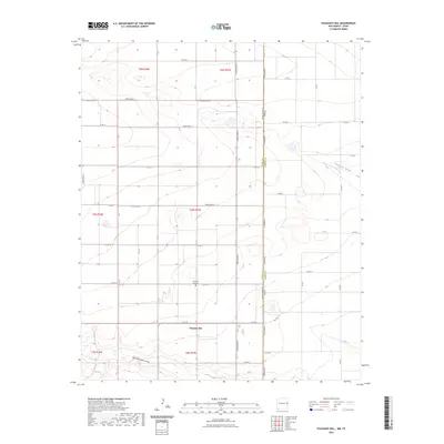
2023 Map of Pleasant Hill
USGS Topo · Published 2023About this map
The agricultural plains of the New Mexico and Texas borderlands are defined by the rigid grid of the Public Land Survey System in this contemporary topographic study. Centered on Pleasant Hill, the landscape is partitioned into townships such as t4n r37e and t5n r37e, where a dense network of section line roads like Curry Road B and C R 18 facilitates movement across the High Plains. The namesake Pleasant Hill Cem serves as a significant local landmark for genealogists tracing families in this corner of Curry County.
Find a feature on this map
40 named features on this map. Tap any name to fly to it.
Don’t see what you’re looking for? This feature index may not catch every label — zoom into the map to look around manually.
Map Details
Editions of this 2023 Pleasant Hill Map
This is the sole edition of this map. No revisions or reprints were ever made.
Other maps of this area

1954 · Clovis
USGS Topo · 1:250,000

1957 · Clovis
USGS Topo · 1:62,500

1957 · Pleasant Hill
USGS Topo · 1:62,500

1958 · Clovis
USGS Topo · 1:250,000

1963 · Oklahoma Lane
USGS Topo · 1:24,000

1965 · Bovina
USGS Topo · 1:24,000

1965 · Rhea
USGS Topo · 1:24,000

1985 · Pleasant Hill NW
USGS Topo · 1:24,000

1985 · Muleshoe
USGS Topo · 1:100,000

1985 · Pleasant Hill
USGS Topo · 1:24,000