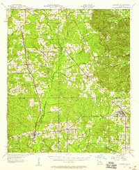
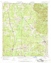
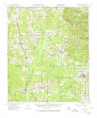
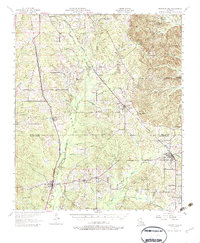
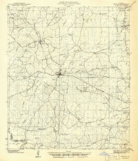
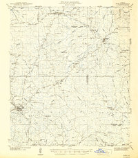
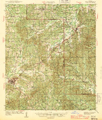
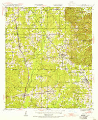
1957 Map of Pleasant Hill
USGS Topo · Published 1958About this map
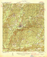
The Kansas City Southern and Texas and Pacific railroads dominate the North Louisiana landscape, connecting a series of rail-dependent communities like Pelican, Oxford, and Converse. This mid-century survey illustrates the rural development of the De Soto and Sabine Parish border, where small settlements are defined by their proximity to these vital transportation arteries. The presence of numerous petroleum and natural gas features, including Gas Wells and scattered Oil Wells, points to the region's industrial transition alongside its agricultural roots.
Find a feature on this map
60 named features on this map. Tap any name to fly to it.
Don’t see what you’re looking for? This feature index may not catch every label — zoom into the map to look around manually.
Map Details
Editions of this 1957 Pleasant Hill Map
4 editions found
Other maps of this area

1938 · Chemard Lake
USGS Topo · 1:31,680

1938 · Hollis Creek
USGS Topo · 1:31,680
1941 · Zwolle
USGS Topo · 1:62,500

1941 · Pelican
USGS Topo · 1:62,500
1942 · Many
USGS Topo · 1:62,500
1943 · Many
USGS Topo · 1:62,500
1943 · Pleasant Hill
USGS Topo · 1:62,500

1944 · Logansport
USGS Topo · 1:62,500

1944 · Patroon
USGS Topo · 1:62,500
1944 · Zwolle
USGS Topo · 1:62,500