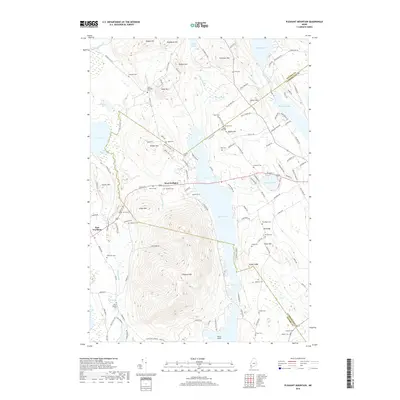
2018 Map of Pleasant Mountain
USGS Topo · Published 2018About this map
Pleasant Mtn dominates the western Maine landscape, rising sharply above the expansive waters of Moose Pond. The settlement patterns recorded in the early 21st century show a transition between the clustered activity at West Bridgton and the more dispersed rural character of East Fryeburg. Numerous small family and local cemeteries, such as Hapworth Cem, Gammay Cem, and Taylor Cem, are scattered throughout the hills, providing a detailed record for genealogists and local historians. To the north, the terrain is characterized by a series of peaks including Black Mtn and Plummer Mtn, separated by water bodies like Webber Pond and Berry Pond. The map also captures specialized ecological features like the Shaking Bog near the mountain's southern slopes, illustrating the complex geography of the Lakes Region.
Find a feature on this map
132 named features on this map. Tap any name to fly to it.
Don’t see what you’re looking for? This feature index may not catch every label — zoom into the map to look around manually.
Map Details
Editions of this 2018 Pleasant Mountain Map
This is the sole edition of this map. No revisions or reprints were ever made.
Other maps of this area

1896 · Norway
USGS Topo · 1:62,500

1896 · Sebago
USGS Topo · 1:62,500

1909 · Fryeburg
USGS Topo · 1:62,500

1910 · Kezar Falls
USGS Topo · 1:48,000

1911 · Fryeburg
USGS Topo · 1:62,500

1911 · Kezar Falls
USGS Topo · 1:62,500

1941 · Fryeburg
USGS Topo · 1:62,500

1942 · Sebago Lake
USGS Topo · 1:62,500

1943 · Sebago Lake
USGS Topo · 1:62,500

1946 · Norway
USGS Topo · 1:62,500