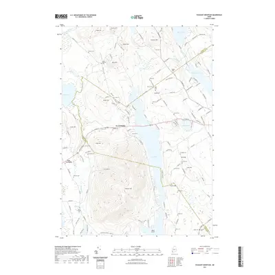
2021 Map of Pleasant Mountain
USGS Topo · Published 2021About this map
Pleasant Mtn dominates the central landscape of this western Maine region, rising between the distinct water bodies of Moose Pond and the wetlands around Kezar Pond. The map reveals a dense network of local roads and family-named landmarks that speak to the area's deep-rooted residential and agricultural history. Numerous small burying grounds, such as Gammay Cem, Mc Lucas Cem, and Douglass Cem, are scattered across the terrain, offering significant value for genealogical research.
Find a feature on this map
141 named features on this map. Tap any name to fly to it.
Don’t see what you’re looking for? This feature index may not catch every label — zoom into the map to look around manually.
Map Details
Editions of this 2021 Pleasant Mountain Map
This is the sole edition of this map. No revisions or reprints were ever made.
Other maps of this area

1896 · Norway
USGS Topo · 1:62,500

1896 · Sebago
USGS Topo · 1:62,500

1909 · Fryeburg
USGS Topo · 1:62,500

1910 · Kezar Falls
USGS Topo · 1:48,000

1911 · Fryeburg
USGS Topo · 1:62,500

1911 · Kezar Falls
USGS Topo · 1:62,500

1941 · Fryeburg
USGS Topo · 1:62,500

1942 · Sebago Lake
USGS Topo · 1:62,500

1943 · Sebago Lake
USGS Topo · 1:62,500

1946 · Norway
USGS Topo · 1:62,500