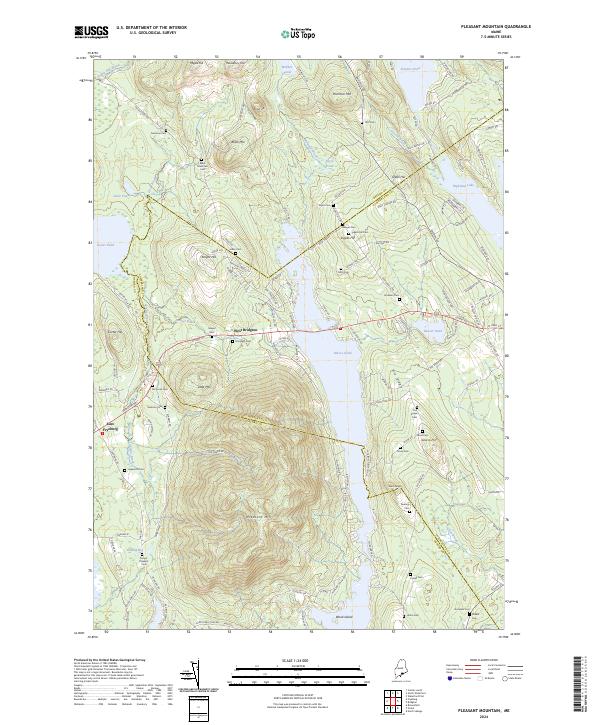
2024 Map of Pleasant Mountain
USGS Topo · Published 2024About this map
Pleasant Mtn dominates the central landscape of this western Maine quadrangle, a significant topographic feature that straddles the line between Cumberland and Oxford counties. This area is a patchwork of water and high ground, where the expansive Moose Pond stretches along the eastern base of the mountain. The mapping reveals a high density of burial sites across the hillsides, such as Ingalls Hill Cem and Mc Lucas Cem, suggesting generations of family settlement in the vicinity of West Bridgton. To the west, the terrain softens into the wetlands of Shaking Bog and the waters of Kezar Pond, near the small community of East Fryeburg. This contemporary survey illustrates how historic land divisions and family names like Hio Ridge and Ingalls Hill remain preserved in the modern Maine infrastructure of firelanes and country roads.
Find a feature on this map
137 named features on this map. Tap any name to fly to it.
Don’t see what you’re looking for? This feature index may not catch every label — zoom into the map to look around manually.
Map Details
Editions of this 2024 Pleasant Mountain Map
This is the sole edition of this map. No revisions or reprints were ever made.
Other maps of this area

1896 · Norway
USGS Topo · 1:62,500

1896 · Sebago
USGS Topo · 1:62,500

1909 · Fryeburg
USGS Topo · 1:62,500

1910 · Kezar Falls
USGS Topo · 1:48,000

1911 · Fryeburg
USGS Topo · 1:62,500

1911 · Kezar Falls
USGS Topo · 1:62,500

1941 · Fryeburg
USGS Topo · 1:62,500

1942 · Sebago Lake
USGS Topo · 1:62,500

1943 · Sebago Lake
USGS Topo · 1:62,500

1946 · Norway
USGS Topo · 1:62,500