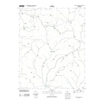
2010 Map of Pleasant Shade
USGS Topo · Published 2010About this map
Pleasant Shade Post Office serves as the focal point of this rural Middle Tennessee landscape, where the headwaters of Old Hickory Lake meet a complex network of ridges and hollows. The area is defined by a dense concentration of family burial grounds, reflecting generations of local lineage in communities like Union Camp. Genealogists will find an exceptional density of named family sites, ranging from the William Butler Cemetery in the northwest to the Cortez Adams Cemetery and Wakefield Family Cemetery further east.
Find a feature on this map
119 named features on this map. Tap any name to fly to it.
Don’t see what you’re looking for? This feature index may not catch every label — zoom into the map to look around manually.
Map Details
Editions of this 2010 Pleasant Shade Map
This is the sole edition of this map. No revisions or reprints were ever made.
Other maps of this area

1931 · Lafayette
USGS Topo · 1:62,500

1931 · Red Boiling Springs
USGS Topo · 1:62,500

1932 · Carthage
USGS Topo · 1:62,500

1956 · Corbin
USGS Topo · 1:250,000

1956 · Nashville
USGS Topo · 1:250,000

1958 · Corbin
USGS Topo · 1:250,000

1958 · Dixon Springs
USGS Topo · 1:24,000
1958 · Lafayette
USGS Topo · 1:24,000

1959 · Nashville
USGS Topo · 1:250,000
1959 · Hillsdale
USGS Topo · 1:24,000