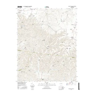
2016 Map of Pleasant Shade
USGS Topo · Published 2016About this map
Lafayette and the rural hills of the Macon Co borderland define this detailed study of the Middle Tennessee landscape. The terrain is characterized by a dense network of hollows and ridges, such as Thomas Ridge and California Hollow, where the settlement pattern follows the narrow creek valleys of Peyton Cr and White Oak Cr. This region, documented in the mid-2010s, reveals a high density of small family burial grounds, including the Wakefield Family Cem, John R Brooks Cem, and the uniquely named Frogpond Friendship Cem, providing a significant record for genealogical research. Small communities and junctions like Gibbs Crossroads and Pleasant Shade serve as local anchors for the surrounding farms. The nomenclature of the landscape, from Wildcat Hollow to Mutton Bluff, reflects a deep local history tied to the physical geography and early homesteads of the Highland Rim.
Find a feature on this map
135 named features on this map. Tap any name to fly to it.
Don’t see what you’re looking for? This feature index may not catch every label — zoom into the map to look around manually.
Map Details
Editions of this 2016 Pleasant Shade Map
This is the sole edition of this map. No revisions or reprints were ever made.
Other maps of this area

1931 · Lafayette
USGS Topo · 1:62,500

1931 · Red Boiling Springs
USGS Topo · 1:62,500

1932 · Carthage
USGS Topo · 1:62,500

1956 · Corbin
USGS Topo · 1:250,000

1956 · Nashville
USGS Topo · 1:250,000

1958 · Corbin
USGS Topo · 1:250,000

1958 · Dixon Springs
USGS Topo · 1:24,000
1958 · Lafayette
USGS Topo · 1:24,000

1959 · Nashville
USGS Topo · 1:250,000
1959 · Hillsdale
USGS Topo · 1:24,000