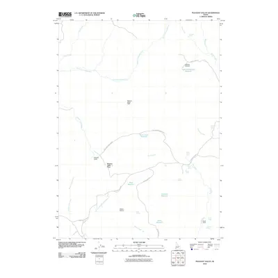
2010 Map of Pleasant Valley
USGS Topo · Published 2010About this map
Pleasant Valley and the surrounding high-desert plateaus of Owyhee County are characterized by a remote landscape of canyons and seasonal water sources. The North Fork Owyhee River carves through the northern reaches of this map, while the high ground of Pleasant Valley Table overlooks the network of drainages below. A series of small-scale water management features, including Indian Battleground Reservoir and Joes Folly Reservoir, suggest the enduring importance of ranching and livestock in this arid environment.
Find a feature on this map
33 named features on this map. Tap any name to fly to it.
Don’t see what you’re looking for? This feature index may not catch every label — zoom into the map to look around manually.
Map Details
Editions of this 2010 Pleasant Valley Map
This is the sole edition of this map. No revisions or reprints were ever made.
Other maps of this area

1955 · Jordan Valley
USGS Topo · 1:250,000

1957 · Jordan Valley
USGS Topo · 1:250,000

1958 · Jordan Valley
USGS Topo · 1:250,000

1973 · Smith Creek
USGS Topo · 1:24,000

1973 · Bedstead Ridge
USGS Topo · 1:24,000

1973 · Castro Table
USGS Topo · 1:24,000

1973 · Indian Meadows
USGS Topo · 1:24,000

1973 · Pleasant Valley
USGS Topo · 1:24,000

1973 · Wickiup Creek
USGS Topo · 1:24,000

1973 · Fairylawn
USGS Topo · 1:24,000