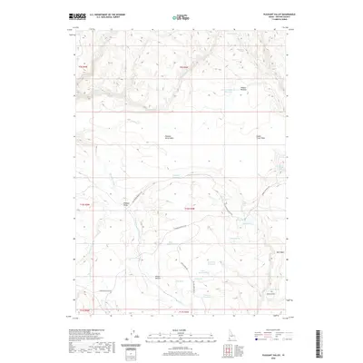
2020 Map of Pleasant Valley
USGS Topo · Published 2020About this map
Pleasant Valley and its surrounding tablelands define this high-desert Owyhee County landscape. The terrain is characterized by broad plateau features like Pleasant Valley Table and Nickel Creek Table, punctuated by a complex network of seasonal water sources and stock reservoirs. Notable among these are Indian Battleground Reservoir and the oddly named Joes Folly Reservoir. The area is navigated via remote routes including Juniper Mountain Rd and the Grasshopper Jeep Trl, reflecting the region's reliance on rugged access for ranching operations. Land use is clearly centered on grazing, with designated areas such as Wilson Pasture and landmarks like the Dutch Oven. This survey captures the intricate hydrography of the high desert, from the N Fork Owyhee River to numerous named springs like Teakettle Spring and Minks Drink.
Find a feature on this map
43 named features on this map. Tap any name to fly to it.
Don’t see what you’re looking for? This feature index may not catch every label — zoom into the map to look around manually.
Map Details
Editions of this 2020 Pleasant Valley Map
This is the sole edition of this map. No revisions or reprints were ever made.
Other maps of this area

1955 · Jordan Valley
USGS Topo · 1:250,000

1957 · Jordan Valley
USGS Topo · 1:250,000

1958 · Jordan Valley
USGS Topo · 1:250,000

1973 · Smith Creek
USGS Topo · 1:24,000

1973 · Bedstead Ridge
USGS Topo · 1:24,000

1973 · Castro Table
USGS Topo · 1:24,000

1973 · Indian Meadows
USGS Topo · 1:24,000

1973 · Pleasant Valley
USGS Topo · 1:24,000

1973 · Wickiup Creek
USGS Topo · 1:24,000

1973 · Fairylawn
USGS Topo · 1:24,000