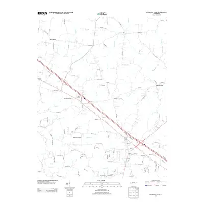
2013 Map of Pleasant View
USGS Topo · Published 2013About this map
Pleasant View serves as a central hub in this Tennessee landscape, where modern transportation corridors intersect with historical rural settlements. The topography is defined by a dense network of waterways, including Buffalo Cr, Raccoon Cr, and Spring Cr, which drain the varied terrain. Smaller crossroads communities such as Stroudville, Turnersville, and Sandy Springs are connected by a web of local roads named for prominent area families, including B G Fort Rd and Dick Farmer Rd. Aviation history is represented by small local airstrips like Blue Bird Field Airport and Weakleys Field Airport, while the presence of Mill Spring near the heart of Pleasant View suggests the foundational water resources that once supported the community. The map illustrates a transition from the agricultural heritage of places like Gause and Oaklawn toward the increasing infrastructure of the early 21st century.
Find a feature on this map
131 named features on this map. Tap any name to fly to it.
Don’t see what you’re looking for? This feature index may not catch every label — zoom into the map to look around manually.
Map Details
Editions of this 2013 Pleasant View Map
This is the sole edition of this map. No revisions or reprints were ever made.
Other maps of this area

1903 · Nashville
USGS Topo · 1:125,000

1931 · Ridgetop
USGS Topo · 1:62,500

1935 · Ridgetop
USGS Topo · 1:62,500

1952 · Springfield North
USGS Topo · 1:24,000

1955 · Forest Grove
USGS Topo · 1:24,000

1956 · Nashville
USGS Topo · 1:250,000

1957 · Cheatham Dam
USGS Topo · 1:24,000

1957 · Adams
USGS Topo · 1:24,000

1957 · Pleasant View
USGS Topo · 1:24,000

1957 · Henrietta
USGS Topo · 1:24,000