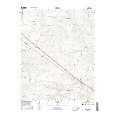
2016 Map of Pleasant View
USGS Topo · Published 2016About this map
Pleasant View sits at the southern edge of this topographic study, where the modern landscape of northern Cheatham and Robertson counties is defined by a dense network of family cemeteries and rural homesteads. The terrain is deeply etched by watercourses such as Millers Creek and Honey Run Cr, creating a rolling agricultural profile punctuated by named clearings like Weakleys Field and Blue Bird Field. Numerous family burial grounds, including the Shepard Cem and Esther Jackson Cem, are scattered across the quadrangle, providing a significant genealogical resource for the descendants of early settlers in Stroudville, Turnersville, and Coopertown. The placement of these cemeteries near former farmsteads and rural crossroads reflects the historic settlement patterns that persisted even as modern infrastructure like the four-lane highway corridor began to reshape the region's connectivity.
Find a feature on this map
140 named features on this map. Tap any name to fly to it.
Don’t see what you’re looking for? This feature index may not catch every label — zoom into the map to look around manually.
Map Details
Editions of this 2016 Pleasant View Map
This is the sole edition of this map. No revisions or reprints were ever made.
Other maps of this area

1903 · Nashville
USGS Topo · 1:125,000

1931 · Ridgetop
USGS Topo · 1:62,500

1935 · Ridgetop
USGS Topo · 1:62,500

1952 · Springfield North
USGS Topo · 1:24,000

1955 · Forest Grove
USGS Topo · 1:24,000

1956 · Nashville
USGS Topo · 1:250,000

1957 · Cheatham Dam
USGS Topo · 1:24,000

1957 · Adams
USGS Topo · 1:24,000

1957 · Pleasant View
USGS Topo · 1:24,000

1957 · Henrietta
USGS Topo · 1:24,000