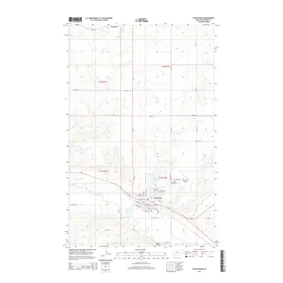
2014 Map of Plentywood
USGS Topo · Published 2014About this map
Plentywood serves as the regional hub in this corner of Sheridan County, situated where Big Muddy Creek meets a network of drainage systems. The town layout is clearly defined by its street grid, including West Central Avenue and East Railroad Avenue, which sit just south of Boxelder Lake. To the north, the small settlement of Raymond rests near the Canadian border, connected to the county seat by MT-16.
Find a feature on this map
41 named features on this map. Tap any name to fly to it.
Don’t see what you’re looking for? This feature index may not catch every label — zoom into the map to look around manually.
Map Details
Editions of this 2014 Plentywood Map
This is the sole edition of this map. No revisions or reprints were ever made.
Other maps of this area

1948 · Antelope
USGS Topo · 1:24,000

1949 · Antelope
USGS Topo · 1:24,000

1950 · Shippe Canyon
USGS Topo · 1:24,000

1954 · Wolf Point
USGS Topo · 1:250,000

1958 · Wolf Point
USGS Topo · 1:250,000

1983 · Plentywood NW
USGS Topo · 1:24,000

1983 · Dooley
USGS Topo · 1:24,000

1983 · Dooley SW
USGS Topo · 1:24,000

1983 · Kisler Butte
USGS Topo · 1:24,000

1983 · Plentywood
USGS Topo · 1:24,000