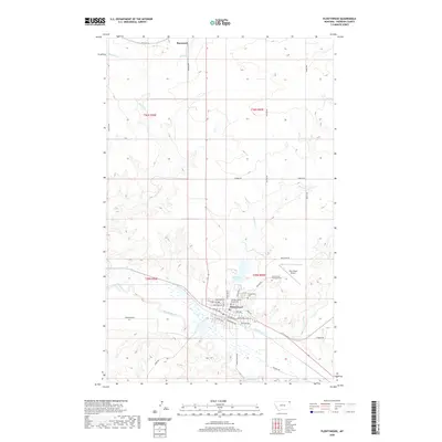
2020 Map of Plentywood
USGS Topo · Published 2020About this map
Plentywood serves as the focal point of this northern Montana landscape, situated at the confluence of the high plains and vital local waterways. The town's grid is anchored by the Sheridan County Courthouse and extends through residential streets like Sunnyside Ave and W Laurel Ave, reflecting its role as a regional hub. To the north, the small settlement of Raymond marks the approach toward the international border, while the surrounding countryside is defined by a dendritic drainage pattern including McCoy Cr and Boxelder Cr. This survey illustrates the modern layout of the community, from the industrial character of E Railroad Ave to the quiet grounds of Plentywood Cem and Plentywood Memorial Cem. The presence of Boxelder Lake and the nearby Sher-Wood Airport highlights the mixture of natural hydrology and regional transportation infrastructure that sustains this prairie landscape.
Find a feature on this map
43 named features on this map. Tap any name to fly to it.
Don’t see what you’re looking for? This feature index may not catch every label — zoom into the map to look around manually.
Map Details
Editions of this 2020 Plentywood Map
This is the sole edition of this map. No revisions or reprints were ever made.
Other maps of this area

1948 · Antelope
USGS Topo · 1:24,000

1949 · Antelope
USGS Topo · 1:24,000

1950 · Shippe Canyon
USGS Topo · 1:24,000

1954 · Wolf Point
USGS Topo · 1:250,000

1958 · Wolf Point
USGS Topo · 1:250,000

1983 · Plentywood NW
USGS Topo · 1:24,000

1983 · Dooley
USGS Topo · 1:24,000

1983 · Dooley SW
USGS Topo · 1:24,000

1983 · Kisler Butte
USGS Topo · 1:24,000

1983 · Plentywood
USGS Topo · 1:24,000