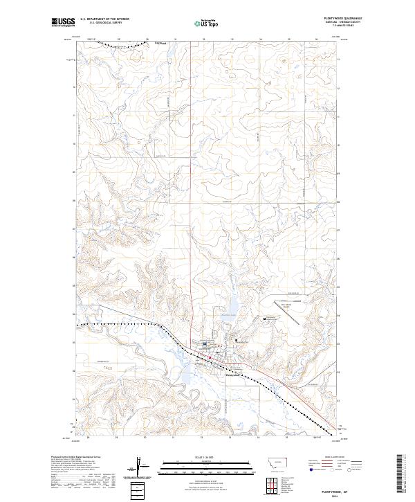
2024 Map of Plentywood
USGS Topo · Published 2024About this map
Plentywood serves as the focal point of this northern Montana landscape, situated at the confluence of the sprawling Big Muddy Creek and its local tributaries. The town layout is clearly defined by historical landmarks such as the Sheridan County Courthouse and essential community services like the Plentywood Cem and Plentywood Memorial Cem. North of the main settlement, the smaller community of Raymond marks the approach to the Canadian border, connected by a network of rural roads such as Raymond Rd and Santa Fe Rd. The geography is characterized by several drainage systems, including Boxelder Creek, which feeds into Boxelder Lake, and McCoy Creek to the west. This modern survey illustrates the persistent importance of aviation and regional government in Sheridan County, anchored by the Sher-Wood Airport and the local street grid extending from W Central Ave to E Northern Ave.
Find a feature on this map
42 named features on this map. Tap any name to fly to it.
Don’t see what you’re looking for? This feature index may not catch every label — zoom into the map to look around manually.
Map Details
Editions of this 2024 Plentywood Map
This is the sole edition of this map. No revisions or reprints were ever made.
Other maps of this area

1948 · Antelope
USGS Topo · 1:24,000

1949 · Antelope
USGS Topo · 1:24,000

1950 · Shippe Canyon
USGS Topo · 1:24,000

1954 · Wolf Point
USGS Topo · 1:250,000

1958 · Wolf Point
USGS Topo · 1:250,000

1983 · Plentywood NW
USGS Topo · 1:24,000

1983 · Dooley
USGS Topo · 1:24,000

1983 · Dooley SW
USGS Topo · 1:24,000

1983 · Kisler Butte
USGS Topo · 1:24,000

1983 · Plentywood
USGS Topo · 1:24,000