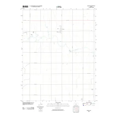
2009 Map of Plevna
USGS Topo · Published 2009About this map
Plevna serves as the central hub of this agricultural landscape in central Kansas, situated north of the meandering North Fork Ninnescah River. The geography is defined by a strict section-line road grid, including Mills Ave and Arlington Rd, which carve the plains into productive plots. This 2009 survey highlights a cluster of significant local landmarks that provide insight into the area's rural community structure. Genealogy researchers will find several well-distributed burial grounds such as Hazen Cemetery, Plevna Cemetery, Langdon Cemetery, and Bainum Cemetery. Near a sharp bend in the river, Hazen Park Camp stands as a rare recreational waypoint amidst the surrounding fields, while roads like Jordan Springs Rd and Irish Creek Rd hint at the historical water sources and early transport routes that shaped Reno County's settlement patterns.
Find a feature on this map
22 named features on this map. Tap any name to fly to it.
Don’t see what you’re looking for? This feature index may not catch every label — zoom into the map to look around manually.
Map Details
Editions of this 2009 Plevna Map
This is the sole edition of this map. No revisions or reprints were ever made.
Other maps of this area

1892 · Kingman
USGS Topo · 1:125,000

1894 · Kingman
USGS Topo · 1:125,000

1894 · Lyons
USGS Topo · 1:125,000

1955 · Great Bend
USGS Topo · 1:250,000

1955 · Pratt
USGS Topo · 1:250,000

1957 · Great Bend
USGS Topo · 1:250,000

1958 · Great Bend
USGS Topo · 1:250,000

1959 · Pratt
USGS Topo · 1:250,000

1966 · Sterling SW
USGS Topo · 1:24,000
1971 · Little Salt Marsh
USGS Topo · 1:24,000