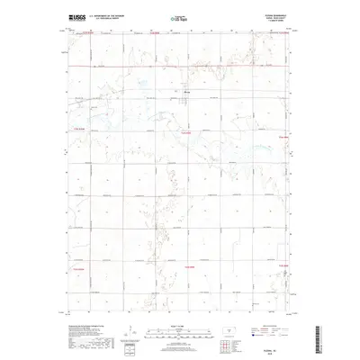
2018 Map of Plevna
USGS Topo · Published 2018About this map
Plevna sits at the heart of this Reno County landscape, a small prairie settlement defined by the grid of rural roads and the winding course of the N Fork Ninnescah River. The terrain is characterized by the river's drainage patterns and a series of localized depressions and wetlands typical of this part of Kansas. Genealogists will find significant value in the distribution of local burial sites, including the Pleven Cem near the town center, Hazen Cem to the west, and both Old Langdon Cem and Bainum Cem in the southern reaches of the quadrangle. The road network, with names like Trail West Rd and Lake Cable Rd, reflects a mix of modern transit and historical thoroughfares that have served the agricultural community for generations.
Find a feature on this map
35 named features on this map. Tap any name to fly to it.
Don’t see what you’re looking for? This feature index may not catch every label — zoom into the map to look around manually.
Map Details
Editions of this 2018 Plevna Map
This is the sole edition of this map. No revisions or reprints were ever made.
Other maps of this area

1892 · Kingman
USGS Topo · 1:125,000

1894 · Kingman
USGS Topo · 1:125,000

1894 · Lyons
USGS Topo · 1:125,000

1955 · Great Bend
USGS Topo · 1:250,000

1955 · Pratt
USGS Topo · 1:250,000

1957 · Great Bend
USGS Topo · 1:250,000

1958 · Great Bend
USGS Topo · 1:250,000

1959 · Pratt
USGS Topo · 1:250,000

1966 · Sterling SW
USGS Topo · 1:24,000
1971 · Little Salt Marsh
USGS Topo · 1:24,000