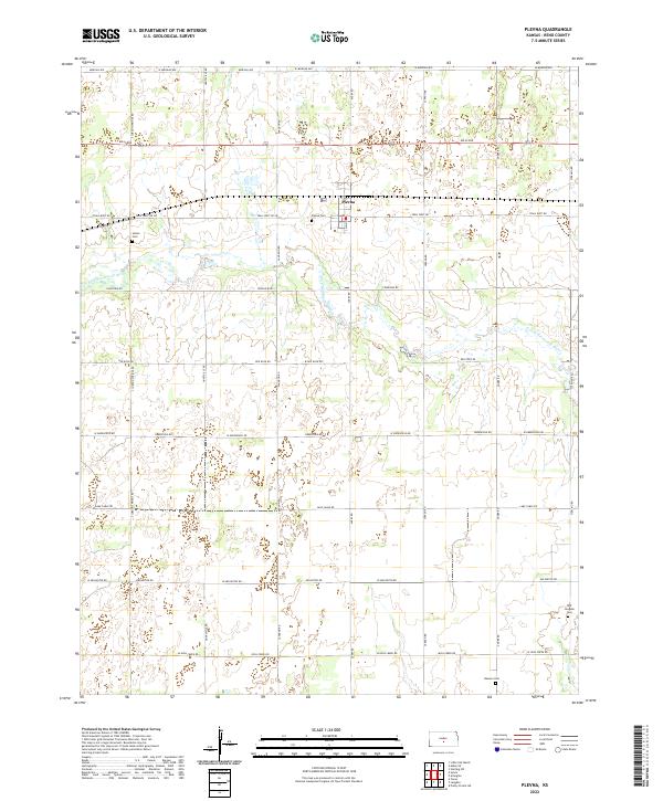
2022 Map of Plevna
USGS Topo · Published 2022About this map
The town of Plevna serves as the focal point of this Reno County landscape, where the agricultural grid is defined by a series of section-line roads and family-named routes. The N Fork Ninnescah River meanders across the central and northern sections, creating the primary break in the otherwise systematic survey of the plains. Genealogical interest is concentrated in several burial grounds scattered throughout the township, including Plevna Cem near the town center and Hazen Cem to the west. Farther south, the Bainum Cem and the Old Langdon Cem mark early settlement nodes along the county line. The presence of routes like Huntsville Rd and Trail West Rd indicates a network established to connect rural farmsteads to the regional grain and rail hubs.
Find a feature on this map
37 named features on this map. Tap any name to fly to it.
Don’t see what you’re looking for? This feature index may not catch every label — zoom into the map to look around manually.
Map Details
Editions of this 2022 Plevna Map
This is the sole edition of this map. No revisions or reprints were ever made.
Other maps of this area

1892 · Kingman
USGS Topo · 1:125,000

1894 · Kingman
USGS Topo · 1:125,000

1894 · Lyons
USGS Topo · 1:125,000

1955 · Great Bend
USGS Topo · 1:250,000

1955 · Pratt
USGS Topo · 1:250,000

1957 · Great Bend
USGS Topo · 1:250,000

1958 · Great Bend
USGS Topo · 1:250,000

1959 · Pratt
USGS Topo · 1:250,000

1966 · Sterling SW
USGS Topo · 1:24,000
1971 · Little Salt Marsh
USGS Topo · 1:24,000