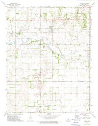
1971 Map of Plevna
USGS Topo · Published 1974About this map
Plevna serves as the central hub of this agricultural landscape in Reno County, where the iron rails of the Atchison Topeka and Santa Fe railroad bisect the northern plains. The terrain is defined by the winding course of the North Fork S Ninnescah River, which meanders through the central sections, influenced by a high water table evidenced by a Flowing Well and several marshy depressions.
Find a feature on this map
27 named features on this map. Tap any name to fly to it.
Don’t see what you’re looking for? This feature index may not catch every label — zoom into the map to look around manually.
Map Details
Editions of this 1971 Plevna Map
This is the sole edition of this map. No revisions or reprints were ever made.
Other maps of this area

1892 · Kingman
USGS Topo · 1:125,000

1894 · Kingman
USGS Topo · 1:125,000

1894 · Lyons
USGS Topo · 1:125,000

1955 · Great Bend
USGS Topo · 1:250,000

1955 · Pratt
USGS Topo · 1:250,000

1957 · Great Bend
USGS Topo · 1:250,000

1958 · Great Bend
USGS Topo · 1:250,000

1959 · Pratt
USGS Topo · 1:250,000

1966 · Sterling SW
USGS Topo · 1:24,000
1971 · Little Salt Marsh
USGS Topo · 1:24,000