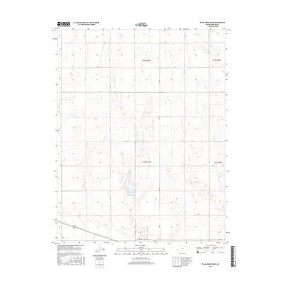
2015 Map of Plum Creek South
USGS Topo · Published 2015About this map
Hamilton-County State Lake sits as a central water feature in this portion of the Kansas High Plains, surrounded by a sparse network of county roads. The landscape is defined by the drainage patterns of Plum Cr and Sand Cr, which cut through the terrain as they move toward the southern edge of the quadrangle. Near the southern border, the Arkansas River flows through the valley, accompanied by the Alamo Ditch, an irrigation feature reflecting the region's agricultural reliance on water management. The map's grid-like road system, including RD 13 and RD N, underscores the late-twentieth-century rural development of Hamilton County, where vast tracts of land are organized by section lines. This 2015 update provides a clear view of the topographic contours and hydrography before any modern changes to the prairie landscape.
Find a feature on this map
25 named features on this map. Tap any name to fly to it.
Don’t see what you’re looking for? This feature index may not catch every label — zoom into the map to look around manually.
Map Details
Editions of this 2015 Plum Creek South Map
This is the sole edition of this map. No revisions or reprints were ever made.
Other maps of this area

1900 · Syracuse
USGS Topo · 1:125,000

1920 · Syracuse
USGS Topo · 1:125,000

1955 · Dodge City
USGS Topo · 1:250,000

1955 · Scott City
USGS Topo · 1:250,000

1958 · Dodge City
USGS Topo · 1:250,000

1958 · Scott City
USGS Topo · 1:250,000

1959 · Dodge City
USGS Topo · 1:250,000
1966 · Tribune 3 SW
USGS Topo · 1:24,000

1966 · Syracuse East
USGS Topo · 1:24,000
1966 · Syracuse West
USGS Topo · 1:24,000