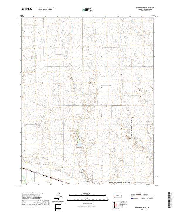
2022 Map of Plum Creek South
USGS Topo · Published 2022About this map
The Arkansas River and the agricultural infrastructure of Hamilton County define this western Kansas landscape. The Alamo Ditch runs parallel to the river's path through the southern reaches of the quadrangle, illustrating the vital importance of irrigation to this high plains region. The terrain is characterized by a network of drainage systems, including the namesake Plum Cr and Sand Cr, which cut through the open country. This 2022 survey captures a strictly rural environment, organized by a rigid grid of local roads such as RD K and RD 11. The mapping highlights the Public Land Survey System divisions, featuring township and range lines like t23s r41w that have governed land ownership and agricultural boundaries in this part of Kansas for over a century.
Find a feature on this map
26 named features on this map. Tap any name to fly to it.
Don’t see what you’re looking for? This feature index may not catch every label — zoom into the map to look around manually.
Map Details
Editions of this 2022 Plum Creek South Map
This is the sole edition of this map. No revisions or reprints were ever made.
Other maps of this area

1900 · Syracuse
USGS Topo · 1:125,000

1920 · Syracuse
USGS Topo · 1:125,000

1955 · Dodge City
USGS Topo · 1:250,000

1955 · Scott City
USGS Topo · 1:250,000

1958 · Dodge City
USGS Topo · 1:250,000

1958 · Scott City
USGS Topo · 1:250,000

1959 · Dodge City
USGS Topo · 1:250,000
1966 · Tribune 3 SW
USGS Topo · 1:24,000

1966 · Syracuse East
USGS Topo · 1:24,000
1966 · Syracuse West
USGS Topo · 1:24,000