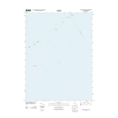
2013 Map of Plum Island OE E
USGS Topo · Published 2013About this map
Great Gull Island and Little Gull Island anchor the western edge of this maritime study, positioned where the Long Island Sound meets the Atlantic Ocean. The area is dominated by the treacherous waters of The Race, a high-velocity tidal strait known for its underwater obstacles such as Race Rock, Valiant Rock, and the submerged Race Point Ledge. This 2013 survey illustrates the complex nautical environment off the coast of Suffolk County, documenting the specific hazards that have historically challenged navigators in these eastern Long Island waters. A single transit line, the New London-Montauk Ferry, cuts diagonally across the open sea, connecting these coastal regions. Farther south, the isolated Constellation Rock sits alone in the deep water, emphasizing the sparse but critical topographical landmarks that define this stretch of the Atlantic.
Find a feature on this map
11 named features on this map. Tap any name to fly to it.
Don’t see what you’re looking for? This feature index may not catch every label — zoom into the map to look around manually.
Map Details
Editions of this 2013 Plum Island OE E Map
This is the sole edition of this map. No revisions or reprints were ever made.
Other maps of this area

1889 · Stonington
USGS Topo · 1:62,500

1892 · New London
USGS Topo · 1:62,500

1893 · Stonington
USGS Topo · 1:62,500

1893 · New London
USGS Topo · 1:62,500

1903 · Gardiners Island
USGS Topo · 1:62,500

1904 · Gardiners Island
USGS Topo · 1:62,500

1904 · Montauk
USGS Topo · 1:62,500

1921 · Gardiners Island
USGS Topo · 1:62,500

1921 · New London
USGS Topo · 1:62,500

1921 · Stonington
USGS Topo · 1:62,500