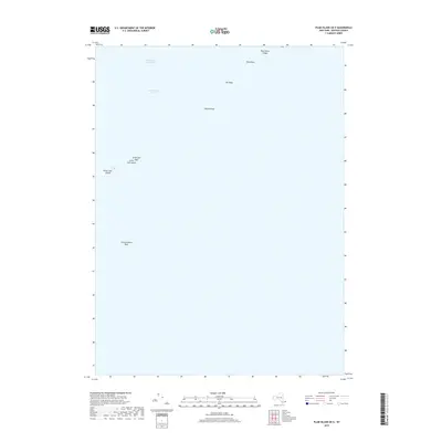
2019 Map of Plum Island OE E
USGS Topo · Published 2019About this map
Great Gull Island and Little Gull Island anchor this nautical survey of the eastern reach of Long Island Sound, marking a critical maritime gateway. This area is dominated by The Race, a powerful tidal channel where the sound meets the Atlantic, shaped by underwater features such as Valiant Rock and Race Point Ledge. Navigational hazards are clearly marked, including the prominent Race Rock and the outlying Constellation Rock to the southwest. The presence of the Intracoastal Waterway through these waters underscores the region's enduring importance as a coastal transit corridor. While primarily an aquatic record, the map captures the isolation of these rocky outposts and the submerged Little Gull Reef that have challenged mariners for generations.
Find a feature on this map
10 named features on this map. Tap any name to fly to it.
Don’t see what you’re looking for? This feature index may not catch every label — zoom into the map to look around manually.
Map Details
Editions of this 2019 Plum Island OE E Map
This is the sole edition of this map. No revisions or reprints were ever made.
Other maps of this area

1889 · Stonington
USGS Topo · 1:62,500

1892 · New London
USGS Topo · 1:62,500

1893 · Stonington
USGS Topo · 1:62,500

1893 · New London
USGS Topo · 1:62,500

1903 · Gardiners Island
USGS Topo · 1:62,500

1904 · Gardiners Island
USGS Topo · 1:62,500

1904 · Montauk
USGS Topo · 1:62,500

1921 · Gardiners Island
USGS Topo · 1:62,500

1921 · New London
USGS Topo · 1:62,500

1921 · Stonington
USGS Topo · 1:62,500