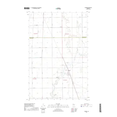
2019 Map of Plummer
USGS Topo · Published 2019About this map
The Clearwater River snakes through the center of this rural landscape, crossing the county line between Pennington and Red Lake counties. At the heart of the region sits Plummer, a settlement defined by a grid of streets including Minnesota St and Central Ave. The surrounding prairie is heavily managed by an extensive drainage system, notably County-Ditch-Number-Sixty-two and County-Ditch-Number-Fifty-seven, which support the area's agricultural character. For those tracing family history, several prominent burial sites are documented across the townships, including the Clara Lutheran Cem in the northwest and Saint Vincent De Paul Cem near the river. Other local landmarks like the Emardville Cem and Clearwater Cem further ground the community's genealogy within this section of northern Minnesota.
Find a feature on this map
51 named features on this map. Tap any name to fly to it.
Don’t see what you’re looking for? This feature index may not catch every label — zoom into the map to look around manually.
Map Details
Editions of this 2019 Plummer Map
This is the sole edition of this map. No revisions or reprints were ever made.
Other maps of this area

1918 · Terrebonne
USGS Topo · 1:62,500

1919 · Grit
USGS Topo · 1:62,500

1943 · Thief River Falls
USGS Topo · 1:62,500

1952 · Grand Forks
USGS Topo · 1:250,000

1952 · Thief River Falls
USGS Topo · 1:250,000

1954 · Bemidji
USGS Topo · 1:250,000

1954 · Roseau
USGS Topo · 1:250,000

1956 · Thief River Falls
USGS Topo · 1:250,000

1956 · Grand Forks
USGS Topo · 1:250,000

1957 · Roseau
USGS Topo · 1:250,000