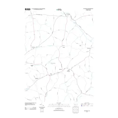
2013 Map of Plumville
USGS Topo · Published 2013About this map
Plumville and its surrounding rural hamlets define this landscape in western Pennsylvania, where small settlements are clustered along winding valley roads. The area is characterized by a dense network of watercourses, including the N Br Plum Cr and S Br Plum Cr, which shaped the early development of milling sites like Hoosicks Mill. By this early 21st-century era, the map shows the transition from traditional agriculture and industry to modern recreation and infrastructure, as seen in the presence of Keystone Lake and Mahoning Creek Lake on the periphery. Genealogists can trace family locations through named settlements such as Barnards, Denton, and Sagamore, while the inclusion of Skunk Hollow Airport provides a specific look at local aviation history. The road network, including Baker Trail Rd, connects these scattered communities across the rolling Indiana County terrain.
Find a feature on this map
96 named features on this map. Tap any name to fly to it.
Don’t see what you’re looking for? This feature index may not catch every label — zoom into the map to look around manually.
Map Details
Editions of this 2013 Plumville Map
This is the sole edition of this map. No revisions or reprints were ever made.
Other maps of this area

1901 · Rural Valley
USGS Topo · 1:62,500

1902 · Indiana
USGS Topo · 1:62,500

1902 · Elders Ridge
USGS Topo · 1:62,500

1903 · Rural Valley
USGS Topo · 1:62,500

1904 · Elders Ridge
USGS Topo · 1:62,500

1909 · Smicksburg
USGS Topo · 1:62,500

1938 · Smicksburg
USGS Topo · 1:62,500

1939 · Smicksburg
USGS Topo · 1:62,500

1953 · Pittsburgh
USGS Topo · 1:250,000

1954 · Pittsburgh
USGS Topo · 1:250,000