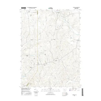
2016 Map of Plumville
USGS Topo · Published 2016About this map
The rolling hills of the Pennsylvania plateau define the landscape around Plumville, where the border between Armstrong Co and Indiana Co zig-zags through small agricultural and industrial communities. This modern survey reflects a region long shaped by its watercourses, including the S Br Cowanshannock Cr and N Br Plum Cr, which provide natural corridors for the area's secondary roads. The map reveals a dense network of local history markers, particularly concentrated around the village of Beyer, where several religious and burial sites such as Saints Peter and Paul Cem and Sacred Heart Cem are situated.
Find a feature on this map
72 named features on this map. Tap any name to fly to it.
Don’t see what you’re looking for? This feature index may not catch every label — zoom into the map to look around manually.
Map Details
Editions of this 2016 Plumville Map
This is the sole edition of this map. No revisions or reprints were ever made.
Other maps of this area

1901 · Rural Valley
USGS Topo · 1:62,500

1902 · Indiana
USGS Topo · 1:62,500

1902 · Elders Ridge
USGS Topo · 1:62,500

1903 · Rural Valley
USGS Topo · 1:62,500

1904 · Elders Ridge
USGS Topo · 1:62,500

1909 · Smicksburg
USGS Topo · 1:62,500

1938 · Smicksburg
USGS Topo · 1:62,500

1939 · Smicksburg
USGS Topo · 1:62,500

1953 · Pittsburgh
USGS Topo · 1:250,000

1954 · Pittsburgh
USGS Topo · 1:250,000