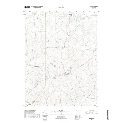
2019 Map of Plumville
USGS Topo · Published 2019About this map
The hills of northern Indiana County are defined by the winding course of Cowanshannock Cr and its tributaries, where rural settlements like Sagamore, Plumville, and Beyer follow the valley floors. This area preserves a high density of early religious and burial sites, including the Old Mahoning Baptist Cem and several denominations represented at Saint Johns Cem and Saint Mary's Byzantine Cem. These locations, often situated on high ground overlooking the creek forks, reflect the complex genealogical history of the region's early settlers.
Find a feature on this map
108 named features on this map. Tap any name to fly to it.
Don’t see what you’re looking for? This feature index may not catch every label — zoom into the map to look around manually.
Map Details
Editions of this 2019 Plumville Map
This is the sole edition of this map. No revisions or reprints were ever made.
Other maps of this area

1901 · Rural Valley
USGS Topo · 1:62,500

1902 · Indiana
USGS Topo · 1:62,500

1902 · Elders Ridge
USGS Topo · 1:62,500

1903 · Rural Valley
USGS Topo · 1:62,500

1904 · Elders Ridge
USGS Topo · 1:62,500

1909 · Smicksburg
USGS Topo · 1:62,500

1938 · Smicksburg
USGS Topo · 1:62,500

1939 · Smicksburg
USGS Topo · 1:62,500

1953 · Pittsburgh
USGS Topo · 1:250,000

1954 · Pittsburgh
USGS Topo · 1:250,000