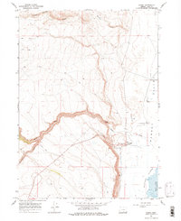
1967 Map of Plush
USGS Topo · Published 1975About this map
Plush sits at the edge of the Warner Valley in Lake County, serving as a hub for the surrounding ranching and wildlife management landscape during the mid-1960s. The map illustrates a transitional zone where high desert drainage systems like Honey Creek and Miners Draw descend toward the Warner Lakes basin. Significant infrastructure for this arid environment is documented through numerous Wells, Gravel Pits, and a remote Landing Strip located north of the settlement. The eastern edge of the survey identifies the Hart Mtn National Antelope Refuge Bdy, highlighting the intersection of human habitation and protected high-desert habitat. Hydrological monitoring is evident at the Gaging Station along the creek, while the presence of a Jeep Trail and Jeep Tr network suggests the seasonal movement and land use patterns of the era.
Find a feature on this map
16 named features on this map. Tap any name to fly to it.
Don’t see what you’re looking for? This feature index may not catch every label — zoom into the map to look around manually.
Map Details
Editions of this 1967 Plush Map
3 editions found
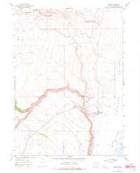
Other maps of this area

1955 · Klamath Falls
USGS Topo · 1:250,000

1955 · Adel
USGS Topo · 1:250,000

1957 · Adel
USGS Topo · 1:250,000

1958 · Klamath Falls
USGS Topo · 1:250,000

1958 · Adel
USGS Topo · 1:250,000

1962 · Adel
USGS Topo · 1:250,000

1967 · Flagstaff Lake
USGS Topo · 1:24,000

1967 · Plush
USGS Topo · 1:24,000

1967 · Rabbit Hills SW
USGS Topo · 1:24,000

1967 · Priday Reservoir
USGS Topo · 1:24,000