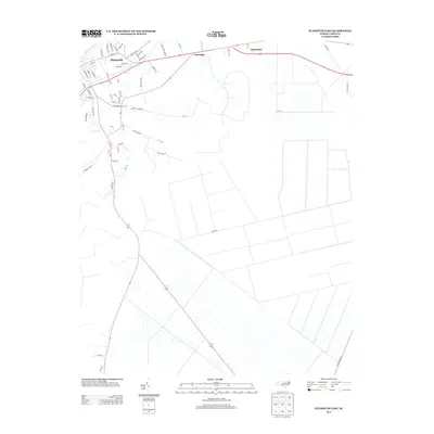
2013 Map of Plymouth East
USGS Topo · Published 2013About this map
Plymouth serves as the focal point of this coastal plain landscape, situated along the southern banks of the Roanoke River. The settlement pattern reflects a mix of traditional residential streets like Washington St and Madison St alongside modern industrial development, evidenced by Industrial Park Rd on the town's eastern edge. Water defines the local geography, with Conaby Cr winding through the low-lying terrain south of the main river channel.
Find a feature on this map
63 named features on this map. Tap any name to fly to it.
Don’t see what you’re looking for? This feature index may not catch every label — zoom into the map to look around manually.
Map Details
Editions of this 2013 Plymouth East Map
This is the sole edition of this map. No revisions or reprints were ever made.
Other maps of this area

1914 · Belhaven
USGS Topo · 1:48,000

1916 · Belhaven
USGS Topo · 1:62,500

1943 · Plymouth
USGS Topo · 1:125,000

1953 · Rocky Mount
USGS Topo · 1:250,000

1954 · Rocky Mount
USGS Topo · 1:250,000

1954 · Plymouth East
USGS Topo · 1:24,000

1954 · Roper North
USGS Topo · 1:24,000

1954 · Roper South
USGS Topo · 1:24,000

1954 · Westover
USGS Topo · 1:24,000
1954 · Pungo Lake
USGS Topo · 1:24,000