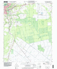
1998 Map of Plymouth East
USGS Topo · Published 2001About this map
Plymouth serves as the focal point for this coastal plain landscape, where the Roanoke River and Conaby Creek define the northern limits of the town near the Bertie County line. The settlement pattern reflects a transition from the structured street grid of the town to a series of rural communities and agricultural research sites. To the east and south, the vast expanse of the East Dismal Swamp dominates the topography, intersected by a network of drainage infrastructure including the Canal and Skinners road.
Find a feature on this map
20 named features on this map. Tap any name to fly to it.
Don’t see what you’re looking for? This feature index may not catch every label — zoom into the map to look around manually.
Map Details
Editions of this 1998 Plymouth East Map
This is the sole edition of this map. No revisions or reprints were ever made.
Other maps of this area

1914 · Belhaven
USGS Topo · 1:48,000

1916 · Belhaven
USGS Topo · 1:62,500

1943 · Plymouth
USGS Topo · 1:125,000

1953 · Rocky Mount
USGS Topo · 1:250,000

1954 · Rocky Mount
USGS Topo · 1:250,000

1954 · Plymouth East
USGS Topo · 1:24,000

1954 · Roper North
USGS Topo · 1:24,000

1954 · Roper South
USGS Topo · 1:24,000

1954 · Westover
USGS Topo · 1:24,000
1954 · Pungo Lake
USGS Topo · 1:24,000