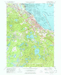
1977 Map of Plymouth
USGS Topo · Published 1978About this map
Plymouth and its historic harbor front anchor this 1970s coastal survey, revealing the dense intersection of modern infrastructure and storied landmarks. The shoreline is defined by heritage sites like Plymouth Rock and the National Monument, while the interior landscape is heavily shaped by the Massachusetts cranberry industry, with numerous Cranberry Bogs dotting the lowlands around the Billington Sea and South Pond.
Find a feature on this map
122 named features on this map. Tap any name to fly to it.
Don’t see what you’re looking for? This feature index may not catch every label — zoom into the map to look around manually.
Map Details
Editions of this 1977 Plymouth Map
4 editions found

Other maps of this area

1885 · Abington
USGS Topo · 1:62,500

1885 · Duxbury
USGS Topo · 1:62,500

1885 · Middleboro
USGS Topo · 1:62,500

1886 · Plymouth
USGS Topo · 1:62,500

1888 · Duxbury
USGS Topo · 1:62,500

1888 · Middleboro
USGS Topo · 1:62,500

1888 · Abington
USGS Topo · 1:62,500

1889 · Plymouth
USGS Topo · 1:62,500

1893 · Abington
USGS Topo · 1:62,500

1893 · Duxbury
USGS Topo · 1:62,500