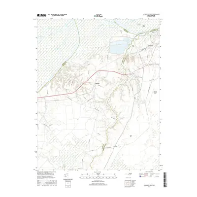
2016 Map of Plymouth West
USGS Topo · Published 2016About this map
The Roanoke River dominates the northern reaches of this coastal plain landscape, winding through a complex system of wetlands including Conoho Swamp and various prongs like Highland Prong. The river’s course is punctuated by Purchase Islands and Huff Island, with Wards Bridge providing a key crossing point near the industrial outskirts of Plymouth. This area serves as a transition from the riverine bottomlands to the agricultural and residential uplands to the south.
Find a feature on this map
68 named features on this map. Tap any name to fly to it.
Don’t see what you’re looking for? This feature index may not catch every label — zoom into the map to look around manually.
Map Details
Editions of this 2016 Plymouth West Map
This is the sole edition of this map. No revisions or reprints were ever made.
Other maps of this area

1914 · Belhaven
USGS Topo · 1:48,000

1916 · Belhaven
USGS Topo · 1:62,500

1943 · Plymouth
USGS Topo · 1:125,000

1953 · Rocky Mount
USGS Topo · 1:250,000

1954 · Rocky Mount
USGS Topo · 1:250,000

1954 · Plymouth East
USGS Topo · 1:24,000

1954 · Westover
USGS Topo · 1:24,000
1954 · Pike Road
USGS Topo · 1:24,000
1978 · Farmlife
USGS Topo · 1:24,000
1978 · Hoke
USGS Topo · 1:24,000