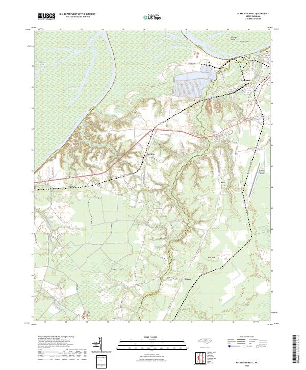
2022 Map of Plymouth West
USGS Topo · Published 2022About this map
The Roanoke River and Middle River wind through the coastal lowlands of Martin and Washington Counties, defining a landscape shaped by water and heavy industry. Near the riverbanks, large-scale industrial operations are visible along Weyco Dr and Pulp Mill Rd, adjacent to the residential streets of western Plymouth. This 2022 survey captures the modern road network, including the path of Highway 64 as it passes the community of Dardens.
Find a feature on this map
68 named features on this map. Tap any name to fly to it.
Don’t see what you’re looking for? This feature index may not catch every label — zoom into the map to look around manually.
Map Details
Editions of this 2022 Plymouth West Map
This is the sole edition of this map. No revisions or reprints were ever made.
Other maps of this area

1914 · Belhaven
USGS Topo · 1:48,000

1916 · Belhaven
USGS Topo · 1:62,500

1943 · Plymouth
USGS Topo · 1:125,000

1953 · Rocky Mount
USGS Topo · 1:250,000

1954 · Rocky Mount
USGS Topo · 1:250,000

1954 · Plymouth East
USGS Topo · 1:24,000

1954 · Westover
USGS Topo · 1:24,000
1954 · Pike Road
USGS Topo · 1:24,000
1978 · Farmlife
USGS Topo · 1:24,000
1978 · Hoke
USGS Topo · 1:24,000