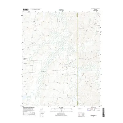
2016 Map of Pocahontas
USGS Topo · Published 2016About this map
Pocahontas stands as a focal point in this portion of Hardeman County, where the Hatchie River and Tuscumbia River define the local drainage patterns. The landscape is characterized by a dense network of creek systems including Muddy Creek, Dry Cypress Creek, and Mosses Creek. This survey records a high concentration of small family and community burial grounds, such as Bethel Cem, Kirk Cem, and Mathis Cem, which are invaluable for genealogical research in this rural Tennessee corridor. The terrain includes notable features like The Mound near the riverbanks and the crossroads at Essary Springs. Industrial and agricultural infrastructure is evident through the inclusion of the Muddy Creek Ditch and local transit routes like Coal Shute Rd and Block Church Rd, providing a clear view of the area's modern rural composition while preserving the locations of historical settlements like Lacy and Middleton.
Find a feature on this map
77 named features on this map. Tap any name to fly to it.
Don’t see what you’re looking for? This feature index may not catch every label — zoom into the map to look around manually.
Map Details
Editions of this 2016 Pocahontas Map
This is the sole edition of this map. No revisions or reprints were ever made.
Other maps of this area

1950 · Corinth
USGS Topo · 1:62,500

1950 · Pocahontas
USGS Topo · 1:24,000

1950 · Hebron
USGS Topo · 1:24,000

1950 · Hornsby
USGS Topo · 1:24,000

1950 · Middleton
USGS Topo · 1:24,000

1951 · Middleton
USGS Topo · 1:24,000

1951 · Hebron
USGS Topo · 1:24,000

1951 · Hornsby
USGS Topo · 1:24,000

1951 · Chewalla
USGS Topo · 1:24,000

1951 · Rose Creek
USGS Topo · 1:24,000