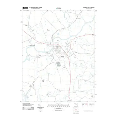
2011 Map of Pocomoke City
USGS Topo · Published 2011About this map
Pocomoke City sits as the central hub of this coastal plain landscape, where the Pocomoke River carves a winding path through the borderlands of Maryland and Virginia. In the early 21st century, the area shows a transition from the established municipal grid of Homewood and Harbor Acres to the rural expanses of West Pocomoke and New Bridge Haven. Genealogists will find a high density of burial sites across the quadrangle, including Saint Marys Cemetery in the city center and the outlying Pitts Creek Cemetery near Cedar Hall. The river remains the dominant geographic feature, fed by tributaries like Dividing Creek and Costen Branch, while local infrastructure is marked by specialized sites such as the Pocomoke City Sewage Lagoon Number One Dam and aviation facilities like Beverly Airport.
Find a feature on this map
96 named features on this map. Tap any name to fly to it.
Don’t see what you’re looking for? This feature index may not catch every label — zoom into the map to look around manually.
Map Details
Editions of this 2011 Pocomoke City Map
This is the sole edition of this map. No revisions or reprints were ever made.
Other maps of this area

1901 · Snow Hill
USGS Topo · 1:62,500

1942 · Kingston
USGS Topo · 1:24,000

1942 · Princess Anne
USGS Topo · 1:24,000

1942 · Snow Hill
USGS Topo · 1:24,000

1942 · Saxis
USGS Topo · 1:24,000

1942 · Dividing Creek
USGS Topo · 1:24,000

1943 · Snow Hill
USGS Topo · 1:31,680

1943 · Dividing Creek
USGS Topo · 1:31,680
1943 · Princess Anne
USGS Topo · 1:31,680

1943 · Saxis
USGS Topo · 1:31,680