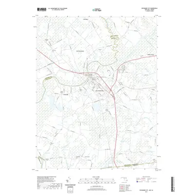
2019 Map of Pocomoke City
USGS Topo · Published 2019About this map
Pocomoke City serves as the focal point of this Eastern Shore landscape, situated where the Pocomoke River divides Worcester Co from Somerset Co. The map reveals a highly structured drainage environment characterized by numerous named swamps and branches, including Wagram Swamp, Cypress Swamp, and Beaverdam Swamp. The settlement pattern is defined by rural crossroads and small communities such as Unionville, West Pocomoke, and Cokesbury.
Find a feature on this map
121 named features on this map. Tap any name to fly to it.
Don’t see what you’re looking for? This feature index may not catch every label — zoom into the map to look around manually.
Map Details
Editions of this 2019 Pocomoke City Map
This is the sole edition of this map. No revisions or reprints were ever made.
Other maps of this area

1901 · Snow Hill
USGS Topo · 1:62,500

1942 · Kingston
USGS Topo · 1:24,000

1942 · Princess Anne
USGS Topo · 1:24,000

1942 · Snow Hill
USGS Topo · 1:24,000

1942 · Saxis
USGS Topo · 1:24,000

1942 · Dividing Creek
USGS Topo · 1:24,000

1943 · Snow Hill
USGS Topo · 1:31,680

1943 · Dividing Creek
USGS Topo · 1:31,680
1943 · Princess Anne
USGS Topo · 1:31,680

1943 · Saxis
USGS Topo · 1:31,680