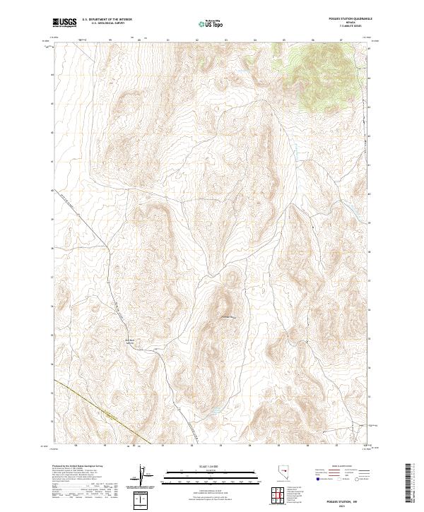
2021 Map of Pogues Station
USGS Topo · Published 2021About this map
The Pancake Range dominates this portion of the high desert along the border of White Pine and Nye counties. This interior basin landscape is defined by its vital water sources, including the secluded Soda Spring and Nevada Governors Spring, which have long served as critical landmarks in an arid environment. The map details the passage of White Pine Co Road 7 as it winds through the topography, crossing the high point at Red Rock Summit. In the northeastern quadrant, the headwaters of Duckwater Cr emerge from the mountain slopes. The survey provides a clear view of the complex land divisions and township boundaries, such as t16n r55e and t15n r54e, reflecting the systematic grid overlaying this remote Nevada terrain.
Find a feature on this map
11 named features on this map. Tap any name to fly to it.
Don’t see what you’re looking for? This feature index may not catch every label — zoom into the map to look around manually.
Map Details
Editions of this 2021 Pogues Station Map
This is the sole edition of this map. No revisions or reprints were ever made.
Other maps of this area

1951 · Green Springs
USGS Topo · 1:62,500

1951 · Pancake Summit
USGS Topo · 1:62,500

1953 · Pinto Summit
USGS Topo · 1:62,500

1956 · Ely
USGS Topo · 1:250,000

1959 · Ely
USGS Topo · 1:250,000

1963 · Ely
USGS Topo · 1:250,000

1964 · Moody Peak
USGS Topo · 1:62,500

1979 · Mt. Hamilton
USGS Topo · 1:100,000

1990 · Pancake Summit SW
USGS Topo · 1:24,000
1990 · Green Springs NW
USGS Topo · 1:24,000