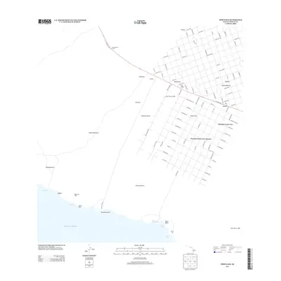
2013 Map of Pohue Bay
USGS Topo · Published 2013About this map
Recent volcanic history defines the landscape around Hawaiian Ocean View, where modern residential grids overlie the hardened paths of the Lava Flow of 1907 and the Lava Flow of 1887. This 2013 survey illustrates the extensive development of the Hawaiian Ocean View Ranchos subdivision, featuring a dense network of roads named for local flora and landmarks, such as Macadamia Dr and Kamaaina Blvd. These planned streets contrast sharply with the ancient kīpuka—islands of older land and vegetation spared by younger lava flows.
Find a feature on this map
79 named features on this map. Tap any name to fly to it.
Don’t see what you’re looking for? This feature index may not catch every label — zoom into the map to look around manually.
Map Details
Editions of this 2013 Pohue Bay Map
This is the sole edition of this map. No revisions or reprints were ever made.
Other maps of this area

1924 · Kalae
USGS Topo · 1:62,500

1924 · Honuapo
USGS Topo · 1:62,500

1928 · Hoopuloa
USGS Topo · 1:62,500

1954 · Hawaii South
USGS Topo · 1:250,000

1959 · Hawaii South
USGS Topo · 1:250,000

1961 · Hawaii South
USGS Topo · 1:250,000

1962 · Hawaii South
USGS Topo · 1:250,000

1962 · Milolii
USGS Topo · 1:24,000

1962 · Puu Hou
USGS Topo · 1:24,000

1962 · Kahuku Ranch
USGS Topo · 1:24,000
Featured Places
- Hawaiian Ocean View, HI
- Hawaiʻi County, HI
- United States
- Hawaii
- Country Garden Estates, Hawaiian Ocean View