Loading...
Loading map...1955 Map of Point Hope
USGS Topo · Published 1970About this map
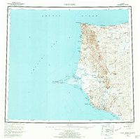
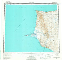
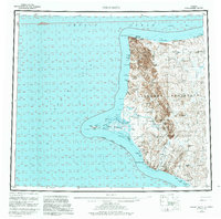
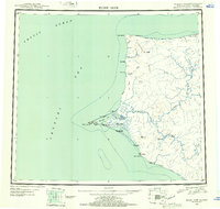
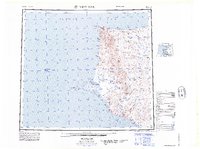
Point Hope sits at the tip of a prominent triangular gravel spit, serving as the primary hub for this remote stretch of the Alaskan coast during the mid-1950s. The landscape is a transition between the Chukchi Sea and the jagged topography of the Lisburne Peninsula. Cultural history is visible in the remnants of former habitations and industrial attempts, such as the Jabbertown (Ruins) and the Corwin Mine located near Corwin Bluff.
Find a feature on this map
134 named features on this map. Tap any name to fly to it.
Don’t see what you’re looking for? This feature index may not catch every label — zoom into the map to look around manually.
Map Details
Date Portrayed1955
Date Published1970
PublisherU.S. Geological Survey
Map TypeTopographic
Scale1:250,000
Physical Dimensions22.4 x 22.2 inches
Editions of this 1955 Point Hope Map
3 editions found
Historical Maps of Point Hope Through Time
3 maps found
Featured Locations
Source Details
SourceU.S. Geological Survey
CopyrightPublic Domain