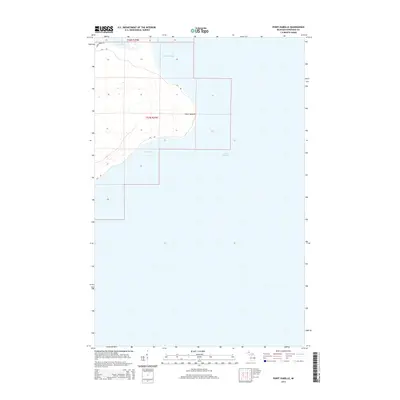
2014 Map of Point Isabelle
USGS Topo · Published 2014About this map
Point Isabelle juts into the cold waters of Lake Superior along the southeastern shore of the Keweenaw Peninsula. This coastal landscape is defined by the transition from the sheltered waters of Bete Grise Bay to the north and Oliver Bay to the south. The interior is characterized by the western reaches of Lac La Belle, where the terrain begins to rise into the wooded uplands typical of the Copper Country. Access to this remote shoreline is maintained via Gay Rd and Montgomery Rd, which trace the contours of the land. The map provides a clear view of the Public Land Survey System grid, including township lines for t58n r29w and t57n r29w, which delineate the historic property divisions of Grant Township.
Find a feature on this map
9 named features on this map. Tap any name to fly to it.
Don’t see what you’re looking for? This feature index may not catch every label — zoom into the map to look around manually.
Map Details
Editions of this 2014 Point Isabelle Map
This is the sole edition of this map. No revisions or reprints were ever made.
Other maps of this area

1927 · Point Isabelle
USGS Topo · 1:31,680

1938 · Delaware
USGS Topo · 1:31,680

1939 · Deer Lake
USGS Topo · 1:31,680

1939 · Delaware
USGS Topo · 1:31,680

1940 · Deer Lake
USGS Topo · 1:31,680

1940 · Fort Wilkins
USGS Topo · 1:31,680

1940 · Lake Medora
USGS Topo · 1:31,680
1948 · Delaware
USGS Topo · 1:24,000
1948 · Lake Medora
USGS Topo · 1:24,000

1948 · Fort Wilkins
USGS Topo · 1:24,000