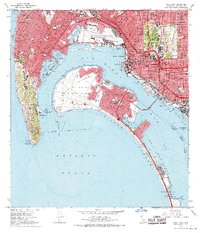
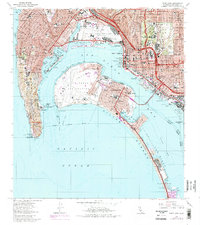
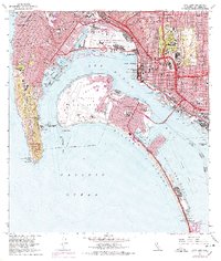
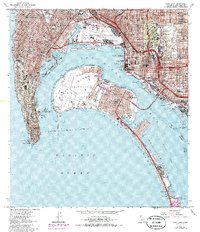
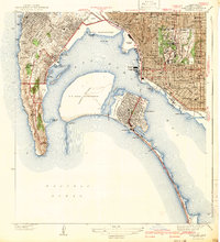
1967 Map of Point Loma
USGS Topo · Published 1970About this map
The maritime and military landscape of San Diego Bay is captured here during a period of significant post-war infrastructure development. The massive footprint of the North Island US Naval Air Station dominates the central harbor, flanked by the US Naval Training Center and the US Marine Corps Recruit Depot. On the mainland, the newly completed San Diego-Coronado Bay Bridge spans the water, fundamentally altering the connection between the city and the Coronado peninsula.
Find a feature on this map
76 named features on this map. Tap any name to fly to it.
Don’t see what you’re looking for? This feature index may not catch every label — zoom into the map to look around manually.
Map Details
Editions of this 1967 Point Loma Map
5 editions found

Other maps of this area

1903 · La Jolla
USGS Topo · 1:62,500

1904 · San Diego
USGS Topo · 1:62,500

1904 · Southern California Sheet No. 2
USGS Topo · 1:250,000

1930 · La Jolla
USGS Topo · 1:62,500

1930 · San Diego
USGS Topo · 1:62,500

1942 · La Mesa
USGS Topo · 1:31,680
1942 · Point Loma
USGS Topo · 1:31,680

1943 · La Jolla
USGS Topo · 1:31,680
1943 · San Ysidro
USGS Topo · 1:31,680

1944 · National City
USGS Topo · 1:31,680