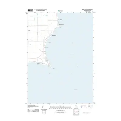
2011 Map of Point Lookout
USGS Topo · Published 2011About this map
Saginaw Bay and Lake Huron dominate the eastern reaches of this Arenac County coastline, where the land tapers to the distinctive peninsula of Point Lookout. This early 21st-century survey documents a landscape defined by seasonal and residential shorefront developments, including Birchwood Shores, Hammell Beach, and Wagner Beach. The mapping reflects a long-standing relationship with the water, indicated by the Ed Wise Fishery near the point and the Gravelly Shoal Light positioned offshore to guide vessels through the bay. Inland, the geography is marked by low-lying wetlands and small water bodies such as Oxbow Lake and Cranberry Lake. For those tracing local families, the presence of the Whitney Sims Cemetery and Sims Cemetery provides a specific point of reference for the genealogy of the Whitney Township area.
Find a feature on this map
40 named features on this map. Tap any name to fly to it.
Don’t see what you’re looking for? This feature index may not catch every label — zoom into the map to look around manually.
Map Details
Editions of this 2011 Point Lookout Map
This is the sole edition of this map. No revisions or reprints were ever made.
Other maps of this area

1954 · Flint
USGS Topo · 1:250,000

1954 · Tawas City
USGS Topo · 1:250,000

1958 · Flint
USGS Topo · 1:250,000

1958 · Tawas City
USGS Topo · 1:250,000

1966 · Point Lookout
USGS Topo · 1:24,000

1966 · Au Gres
USGS Topo · 1:24,000

1966 · Alabaster
USGS Topo · 1:24,000

1966 · National City
USGS Topo · 1:24,000

1970 · Sand Point
USGS Topo · 1:24,000
1970 · Charity Island
USGS Topo · 1:24,000