
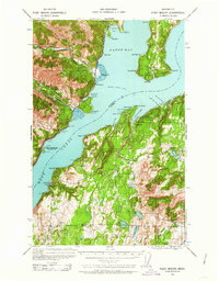
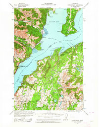
1936 Map of Point Misery
USGS Topo · Published 1958About this map
The Hood Canal and Dabop Bay dominate this landscape, where the rugged mountains of the Olympic National Forest meet the deep inlets of the Kitsap and Toandos peninsulas. In the mid-1930s, the maritime character of the region was defined by the Brinnon Seabeck Ferry route, connecting the timber-heavy western shores to the growing communities on the Kitsap side. At Seabeck, the Seabeck Conference Grounds and Seabeck Sch mark a settlement with deep industrial roots, while further south, the Lewis Lumber Co near Crosby points to the area's active logging economy.
Find a feature on this map
69 named features on this map. Tap any name to fly to it.
Don’t see what you’re looking for? This feature index may not catch every label — zoom into the map to look around manually.
Map Details
Editions of this 1936 Point Misery Map
3 editions found
Other maps of this area

1937 · Port Orchard
USGS Topo · 1:62,500

1937 · Port Gamble
USGS Topo · 1:62,500

1938 · Mt Constance
USGS Topo · 1:125,000

1938 · Allyn
USGS Topo · 1:62,500

1940 · Port Gamble
USGS Topo · 1:62,500

1940 · Point Misery
USGS Topo · 1:62,500

1940 · Quilcene
USGS Topo · 1:62,500

1942 · Gig Harbor
USGS Topo · 1:62,500

1943 · Potlatch
USGS Topo · 1:62,500

1943 · Gig Harbor
USGS Topo · 1:62,500