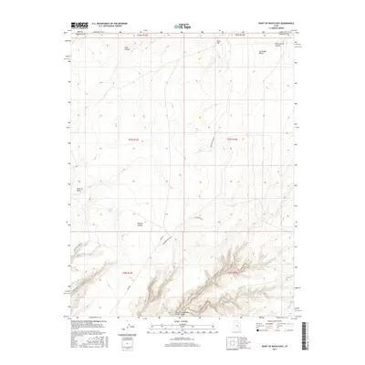
2017 Map of Point of Rocks East
USGS Topo · Published 2017About this map
North Fork Robbers Roost Canyon carves through the southern reaches of this landscape, a stark example of the drainage patterns defining the high desert of Emery County. The terrain is characterized by expansive mesas and deep incisions, with Point of Rocks standing as a prominent navigational marker above the surrounding flats. To the north, the San Rafael Desert stretches toward the horizon, punctuated by the elevations of Texas Hill.
Find a feature on this map
18 named features on this map. Tap any name to fly to it.
Don’t see what you’re looking for? This feature index may not catch every label — zoom into the map to look around manually.
Map Details
Editions of this 2017 Point of Rocks East Map
This is the sole edition of this map. No revisions or reprints were ever made.
Other maps of this area

1885 · San Rafael
USGS Topo · 1:250,000

1953 · Temple Mtn
USGS Topo · 1:62,500

1954 · Stinking Spring Creek 4 SE
USGS Topo · 1:24,000

1956 · Salina
USGS Topo · 1:250,000

1960 · Salina
USGS Topo · 1:250,000

1962 · Salina
USGS Topo · 1:250,000

1963 · Robbers Roost Canyon
USGS Topo · 1:62,500
1963 · Hanksville
USGS Topo · 1:62,500
1963 · The Flat Tops
USGS Topo · 1:62,500
1980 · Hanksville
USGS Topo · 1:100,000