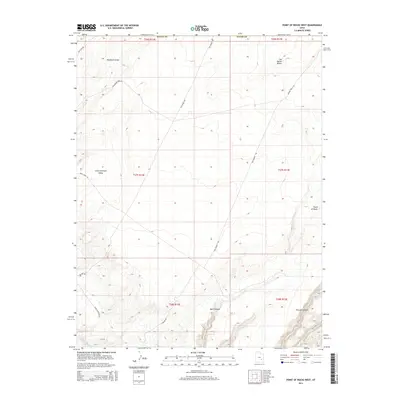
2014 Map of Point of Rocks West
USGS Topo · Published 2014About this map
Little Antelope Valley and the northern reaches of the San Rafael Desert dominate this 2014 survey of the Emery County landscape. The area is defined by its network of drainage systems and canyons, including the significant cuts of Buck Canyon and Pasture Canyon to the south. Human presence is marked primarily by a grid of unpaved access routes like San Rafael Rd and The Square Rd, which navigate the varying elevations between the flats and the eponymous Point of Rocks. The mapping of Blackburn Draw and River Overlook Rd illustrates how the geography dictates movement through this high desert environment, showing a landscape shaped more by natural erosion than dense settlement at the time of the survey.
Find a feature on this map
21 named features on this map. Tap any name to fly to it.
Don’t see what you’re looking for? This feature index may not catch every label — zoom into the map to look around manually.
Map Details
Editions of this 2014 Point of Rocks West Map
This is the sole edition of this map. No revisions or reprints were ever made.
Other maps of this area

1885 · San Rafael
USGS Topo · 1:250,000

1953 · Temple Mtn
USGS Topo · 1:62,500

1954 · Stinking Springs Creek 4 SW
USGS Topo · 1:24,000

1954 · Stinking Spring Creek 4 SE
USGS Topo · 1:24,000

1954 · Mt. Ellen 1 NW
USGS Topo · 1:24,000

1954 · Mt. Ellen 1 SW
USGS Topo · 1:24,000

1956 · Salina
USGS Topo · 1:250,000

1960 · Salina
USGS Topo · 1:250,000

1962 · Salina
USGS Topo · 1:250,000

1963 · Robbers Roost Canyon
USGS Topo · 1:62,500