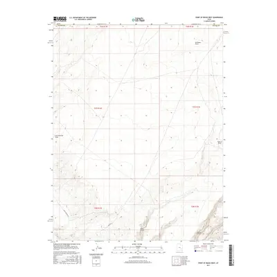
2017 Map of Point of Rocks West
USGS Topo · Published 2017About this map
San Rafael Desert dominates this high-plateau landscape, characterized by the dramatic topography of Point of Rocks and the deep incisions of Buck Canyon and Pasture Canyon. This survey, produced by the U.S. Geological Survey, captures a remote corner of Emery County at the boundary of Wayne County. The arid terrain is marked by the expansive Little Antelope Valley to the west, while a sparse network of access routes like River Overlook Rd and S Square Rd provides the only infrastructure through these public lands. The map illustrates the township and range system, showing the grid of t27s r13e and surrounding sections that define land management in this part of the American West.
Find a feature on this map
14 named features on this map. Tap any name to fly to it.
Don’t see what you’re looking for? This feature index may not catch every label — zoom into the map to look around manually.
Map Details
Editions of this 2017 Point of Rocks West Map
This is the sole edition of this map. No revisions or reprints were ever made.
Other maps of this area

1885 · San Rafael
USGS Topo · 1:250,000

1953 · Temple Mtn
USGS Topo · 1:62,500

1954 · Stinking Springs Creek 4 SW
USGS Topo · 1:24,000

1954 · Stinking Spring Creek 4 SE
USGS Topo · 1:24,000

1954 · Mt. Ellen 1 NW
USGS Topo · 1:24,000

1954 · Mt. Ellen 1 SW
USGS Topo · 1:24,000

1956 · Salina
USGS Topo · 1:250,000

1960 · Salina
USGS Topo · 1:250,000

1962 · Salina
USGS Topo · 1:250,000

1963 · Robbers Roost Canyon
USGS Topo · 1:62,500