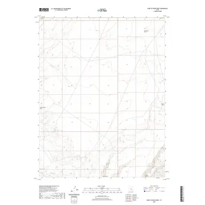
2020 Map of Point of Rocks West
USGS Topo · Published 2020About this map
San Rafael Desert dominates this arid landscape at the border of Emery and Wayne Co. The terrain is characterized by intricate drainage systems and significant elevation changes, most notably at Point of Rocks, which provides a topographical anchor for the surrounding region. The southern reaches are defined by deep cuts into the plateau, including Buck Canyon and Pasture Canyon, revealing the erosive forces that have shaped this portion of Utah. To the west, the Little Antelope Valley offers a distinct geographical break from the desert floor. This 2020 survey is an essential record of the contemporary natural features in a location where the lack of human infrastructure highlights the raw physical geography of the Colorado Plateau.
Find a feature on this map
6 named features on this map. Tap any name to fly to it.
Don’t see what you’re looking for? This feature index may not catch every label — zoom into the map to look around manually.
Map Details
Editions of this 2020 Point of Rocks West Map
This is the sole edition of this map. No revisions or reprints were ever made.
Other maps of this area

1885 · San Rafael
USGS Topo · 1:250,000

1953 · Temple Mtn
USGS Topo · 1:62,500

1954 · Stinking Springs Creek 4 SW
USGS Topo · 1:24,000

1954 · Stinking Spring Creek 4 SE
USGS Topo · 1:24,000

1954 · Mt. Ellen 1 NW
USGS Topo · 1:24,000

1954 · Mt. Ellen 1 SW
USGS Topo · 1:24,000

1956 · Salina
USGS Topo · 1:250,000

1960 · Salina
USGS Topo · 1:250,000

1962 · Salina
USGS Topo · 1:250,000

1963 · Robbers Roost Canyon
USGS Topo · 1:62,500