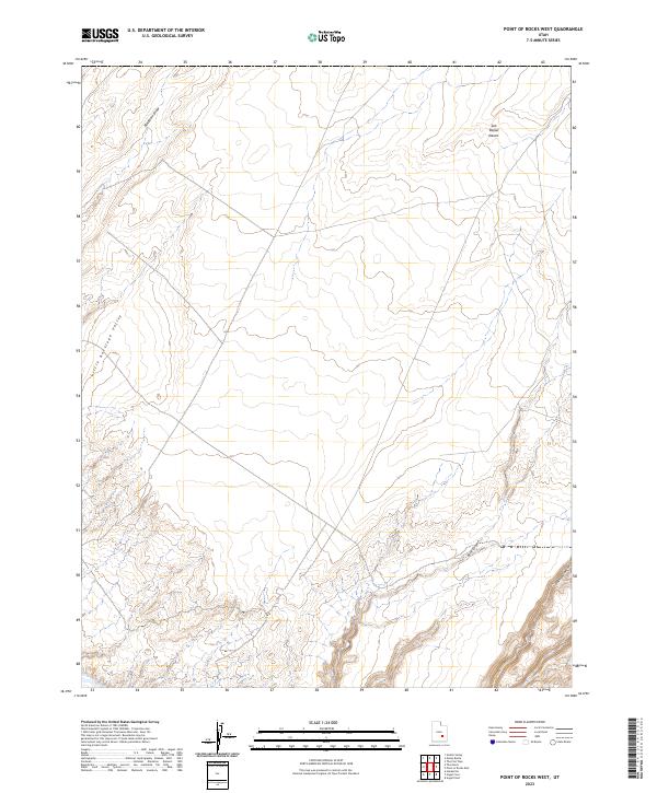
2023 Map of Point of Rocks West
USGS Topo · Published 2023About this map
San Rafael Desert dominates this arid landscape, showing the complex drainage systems of Wayne County in the early 21st century. The topographic data reveals the dramatic transition from the plateau-like expanse of Little Antelope Valley to the deeply incised paths of Buck Canyon and Pasture Canyon. These geological features illustrate the erosional forces that have shaped this portion of Utah over millennia. Along the southern edge, the Dirty Devil River follows a winding course, joined by seasonal drainages such as Blackburn Draw. The absence of developed infrastructure or settlements reflects the enduring wilderness character of this region, which remains largely defined by its natural watercourses and rugged desert terrain.
Find a feature on this map
6 named features on this map. Tap any name to fly to it.
Don’t see what you’re looking for? This feature index may not catch every label — zoom into the map to look around manually.
Map Details
Editions of this 2023 Point of Rocks West Map
This is the sole edition of this map. No revisions or reprints were ever made.
Other maps of this area

1885 · San Rafael
USGS Topo · 1:250,000

1953 · Temple Mtn
USGS Topo · 1:62,500

1954 · Stinking Springs Creek 4 SW
USGS Topo · 1:24,000

1954 · Stinking Spring Creek 4 SE
USGS Topo · 1:24,000

1954 · Mt. Ellen 1 NW
USGS Topo · 1:24,000

1954 · Mt. Ellen 1 SW
USGS Topo · 1:24,000

1956 · Salina
USGS Topo · 1:250,000

1960 · Salina
USGS Topo · 1:250,000

1962 · Salina
USGS Topo · 1:250,000

1963 · Robbers Roost Canyon
USGS Topo · 1:62,500