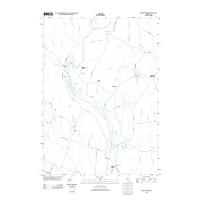
2013 Map of Point Rock
USGS Topo · Published 2013About this map
The Prussian Settlement and a series of historical milling sites characterize this rural landscape north of Rome, New York. Situated along the winding tributaries of the E Br Fish Cr, the area’s economic history is etched into the terrain through labels for Swancott Mill, Freeman Mill, Parson Mill, and Fey Mill. These sites, along with the Swancott Mill Cem, suggest a decentralized industrial pattern typical of early upstate water-powered commerce, where small communities formed around specific family-run operations.
Find a feature on this map
78 named features on this map. Tap any name to fly to it.
Don’t see what you’re looking for? This feature index may not catch every label — zoom into the map to look around manually.
Map Details
Editions of this 2013 Point Rock Map
This is the sole edition of this map. No revisions or reprints were ever made.
Other maps of this area

1904 · Boonville
USGS Topo · 1:62,500

1905 · Port Leyden
USGS Topo · 1:62,500

1905 · Taberg
USGS Topo · 1:62,500

1906 · Highmarket
USGS Topo · 1:62,500

1907 · Port Leyden
USGS Topo · 1:62,500

1940 · Port Leyden
USGS Topo · 1:62,500

1943 · East Florence
USGS Topo · 1:31,680

1943 · Camden East
USGS Topo · 1:31,680

1943 · Lee Center
USGS Topo · 1:31,680
1943 · North Osceola
USGS Topo · 1:24,000